
aisPatrol gives security teams an autonomous aerial responder: incident detection, live video and alarm context from a drone-in-a-box - with GNSS-independent flight when GPS is limited or unavailable. aisTower adds autonomous RGB + LiDAR scanning and a measurable 3D inventory of BTS tower equipment.
Patrol drones, docks and autonomy developed in-house on the SmartDrones stack. GNSS-independent flight (LiDAR-SLAM + INS), software developed toward DO-178C. Made in Poland , for European sites, with NDAA-aligned supply chain on the roadmap.
aisPatrol adds an aerial responder to protected sites. The drone detects people, fire and animals, raises an alarm at the security center and streams live video from the scene.
Register a protected site or tower in the cloud, request patrol coverage, and launch missions from the dashboard. Planning and flight are handled autonomously.
Your data stays under your control. The drone patrols the site on its own, including where GPS is weak or unavailable, using LiDAR-SLAM and INS on the SmartDrones stack.
An alarm alone does not tell security what happened, where it happened or whether a patrol team should be sent.
aisPatrol launches, checks the scene from the air and sends live video, location and event type to the security center.
Operators verify incidents on live video and dispatch the right response.

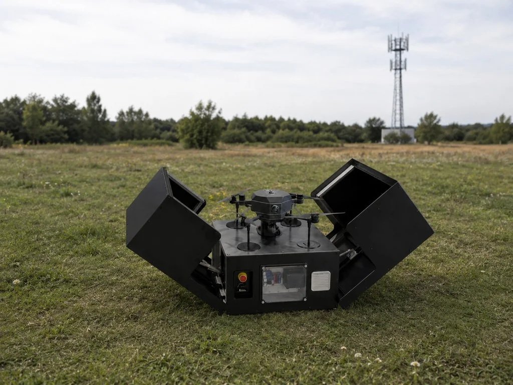
p600 docked and charging in aisDock v1.
Scheduled or triggered autonomous flight.
On-board AI identifies people, fire or animals.
The incident is sent to the security center with location and live view.
The operator verifies the incident and sends the right response.
aisPatrol runs on dedicated patrol hardware: the p600 drone and aisDock v1 for autonomous launch, landing and charging on site.

Patrol drone for autonomous incident detection, live video and mission execution through aisPlanner and aisPilot.

Autonomous take-off, landing and charging for fully unattended patrol operation.
aisTower automates the capture layer of tower documentation. The drone flies around the BTS, collects RGB imagery and LiDAR data, and turns the site into a 3D model. In the AITower application engineers can click tower elements, identify what they are and keep the inventory current.
After every modernization, tenant change or service visit, tower documentation drifts away from the real installation.
RGB + LiDAR capture builds a measurable 3D model of the tower, ready for structured inventory work.
Engineers select an antenna, RRU, bracket or cable route in the model, classify it and keep a clear change history.

aisPlanner generates the tower mission; aisPilot flies autonomously.
The drone captures tower imagery and LiDAR data automatically.
Captured data becomes a tower model for review in the AITower application.
Engineers click model elements and define what each component is.
The result is a structured tower record for audits, upgrades and maintenance.
We develop aisPatrol and aisTower with operators who understand real site constraints and incident response workflows.

Book a demo for aisPatrol or aisTower. Tell us about your site security needs, BTS portfolio or incident response workflow, and we'll show how AITower fits.